When Pilots Followed Train Tracks and Prayed for Good Weather: Aviation's Terrifying Early Days

When Pilots Followed Train Tracks and Prayed for Good Weather: Aviation's Terrifying Early Days
Every day, over 45,000 flights crisscross American airspace in a precisely choreographed ballet of metal and fuel. Pilots receive constant guidance from air traffic controllers, navigate using satellite systems accurate to within feet, and land in conditions that would have been impossible just decades ago. But this invisible infrastructure of safety and precision is so recent that some pilots who learned to fly by following railroad tracks are still alive today.
Navigation by Railroad and River
In the 1920s, American pilots had exactly one reliable navigation method: following visible landmarks on the ground. Railroad tracks were the interstate highways of early aviation. Pilots would spot a railway line and follow it from city to city, hoping it led where they wanted to go.
Rivers served as backup highways in the sky. The Mississippi River was particularly popular among early aviators because it was impossible to miss and generally pointed in useful directions. Pilots learned to read the landscape like maritime captains read coastlines, memorizing distinctive farms, water towers, and church steeples that marked their route.
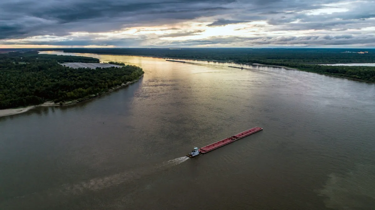 Photo: Mississippi River, via www.americanrivers.org
This system worked fine in clear weather over familiar territory. But fog, storms, or unfamiliar routes turned routine flights into life-or-death navigation puzzles. Pilots carried road maps — literally, automobile road maps — and tried to match what they saw below with what appeared on paper. Getting lost wasn't just inconvenient; it was often fatal when fuel ran out over unfamiliar terrain.
The Bonfire Network That Lit America's Skies
As commercial aviation expanded, the U.S. government created the most primitive air traffic control system imaginable: a nationwide network of bonfires. The Airway Beacon System, established in 1926, placed rotating beacons every 10 miles along major flight routes. These weren't sophisticated radio signals — they were literally giant searchlights that swept the sky in patterns pilots could recognize.
Each beacon flashed a unique Morse code identifier, allowing pilots to confirm their location by counting flashes. During the day, pilots looked for 50-foot concrete arrows painted bright yellow that pointed toward the next beacon. At night, they followed chains of rotating lights that stretched across the American landscape like a primitive GPS system made of fire and concrete.
The system required an army of maintenance workers who lived in remote beacon stations, keeping the lights burning and the equipment operational. When bad weather hit, these workers would literally set oil-soaked rags on fire to create emergency beacons, risking their lives to guide lost pilots to safety.
Weather Forecasting by Dropped Flare
Modern pilots receive detailed weather reports updated every hour, complete with wind speed, visibility, and precipitation forecasts. Early aviators had to create their own weather reports using methods that seem almost comically primitive today.
To determine wind direction and speed, pilots would drop flares or weighted streamers and watch how they drifted. They judged visibility by seeing how far they could spot landmarks below. Cloud height was estimated by flying into them and seeing what happened — a technique that killed numerous pilots who encountered severe turbulence or icing conditions they couldn't predict.
Many pilots carried homing pigeons that they could release with messages if they were forced to land in remote areas. The pigeons often reached civilization faster than search and rescue teams could locate downed aircraft. Some aviators trained their pigeons to fly specific routes, creating biological backup communication systems when radio equipment failed.
The Radio Revolution That Changed Everything
Two-way radio communication between pilots and ground controllers didn't become standard until the 1930s, and even then, coverage was spotty and unreliable. Early radio equipment was so heavy that smaller aircraft couldn't carry it, and static often made communication impossible during storms — exactly when pilots needed help most.
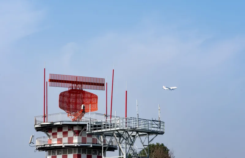
The first air traffic control tower opened at Cleveland Municipal Airport in 1930, but "control" is a generous term. Controllers had no radar and couldn't track aircraft beyond visual range. They relied on pilots to report their positions and intentions, then tried to prevent collisions by suggesting different altitudes or routes.
 Photo: Cleveland Municipal Airport, via static.wixstatic.com
This honor system worked surprisingly well in the early days when air traffic was light, but it became increasingly dangerous as more aircraft filled the skies. Controllers were essentially playing three-dimensional chess with invisible pieces, trying to keep track of multiple aircraft using nothing but radio reports and educated guesswork.
The Radar Revolution
Radar technology, developed during World War II, transformed aviation safety from guesswork into science. For the first time, controllers could actually see aircraft on screens, tracking their exact positions, speeds, and altitudes in real time. Pilots were no longer invisible once they left the airport — they remained under constant observation throughout their flights.
The introduction of radar approach control in the 1950s made landing in poor weather conditions routine rather than heroic. Controllers could guide aircraft through clouds and fog with precision that seemed magical to pilots who had learned to fly by visual landmarks.
Instrument Landing Systems (ILS) allowed pilots to land in conditions that would have grounded flights for days in the early era. The combination of ground-based radio beams and onboard instruments created invisible runways in the sky, guiding aircraft to precise touchdowns even when pilots couldn't see the ground.
The Satellite Age: GPS Changes Everything
The Global Positioning System, originally developed for military use, revolutionized civilian aviation in the 1990s. Suddenly, pilots could determine their exact position anywhere on Earth within a few feet. The days of following railroad tracks and hoping for clear weather were definitively over.
 Photo: Global Positioning System, via brahmaconstructions.work
Modern aircraft fly predetermined routes through the sky called "highways" that exist only in computers and GPS databases. These invisible corridors are as precisely defined as interstate highways, complete with specific altitudes, speeds, and entry and exit points. The chaos of early aviation has been replaced by a system so organized that aircraft routinely pass within miles of each other at different altitudes with complete safety.
Next Generation Air Transportation System (NextGen), currently being implemented across American airspace, uses satellite-based navigation to make air travel even more precise and efficient. Aircraft can now fly more direct routes, land in worse weather, and operate more safely than ever before.
The Invisible Infrastructure We Never See
Today's air traffic control system processes over 16 million flights per year through a network of radar stations, communication systems, and computer databases that operate 24/7. Controllers manage aircraft separation using sophisticated software that tracks hundreds of flights simultaneously, predicting conflicts before they develop and routing traffic around weather systems in real time.
This invisible infrastructure is so reliable that most passengers never think about it. The routine flight from New York to Los Angeles involves coordination between dozens of air traffic control facilities, weather services, and navigation systems — all working seamlessly to ensure safe passage through some of the world's busiest airspace.
From White-Knuckle Terror to Boring Routine
When you board a commercial flight today, you're participating in the safest form of transportation ever invented. The statistical risk of a fatal accident is roughly one in 11 million — safer than driving to the airport. This safety record exists because aviation evolved from the seat-of-the-pants barnstorming era into a highly regulated, technologically sophisticated industry.
The next time your flight is delayed due to "air traffic control," remember that you're experiencing the minor inconvenience of a system designed to prevent the catastrophic accidents that once made aviation a genuinely dangerous adventure. Those early pilots who followed railroad tracks and lit bonfires would be amazed by the invisible safety net that now surrounds every flight — and probably a little envious of how boring flying has become.