The Paper Lies That Guided America: When Every Map Was a Best Guess Wrapped in Confidence
Your phone knows exactly where you are right now — down to the meter. It can guide you through unfamiliar neighborhoods, warn you about traffic jams ahead, and even tell you which lane to be in for your next turn. This pinpoint accuracy feels so natural that it's easy to forget maps used to be elaborate works of educated fiction.
For most of American history, the maps people trusted with their lives were riddled with errors, wild guesses, and outright lies. Cartographers filled in blank spaces with imagination, estimated distances based on rumors, and sometimes invented entire mountain ranges to make their maps look more complete. The consequences were often deadly.
When Guesswork Passed for Geography
In 1776, the same year America declared independence, most maps of the western territories contained more fiction than fact. The famous Mitchell Map, used during peace negotiations after the Revolutionary War, placed the Mississippi River hundreds of miles from its actual location. This wasn't a minor surveying error — it was a cartographic catastrophe that would later trigger boundary disputes lasting decades.
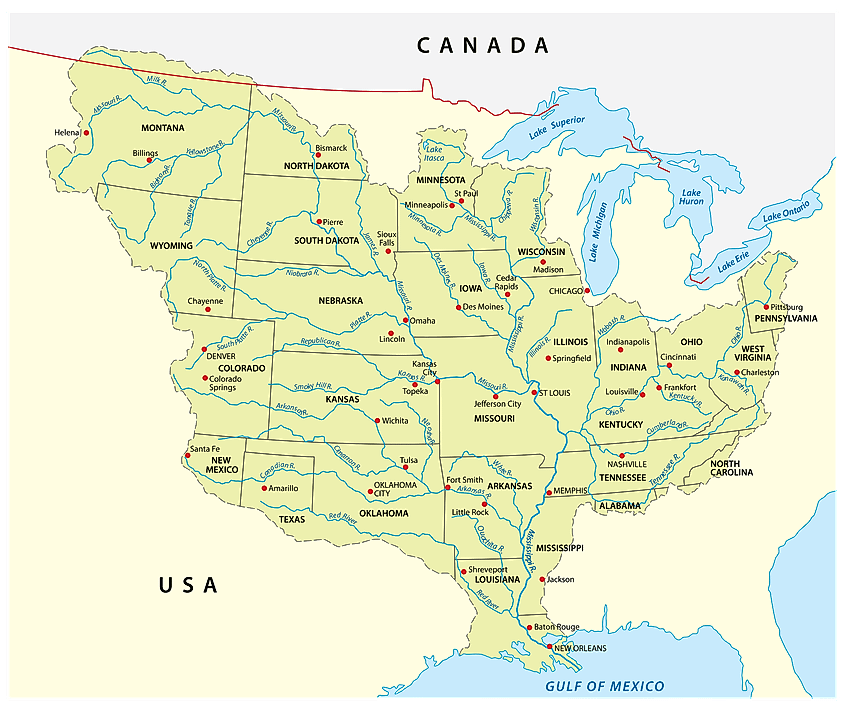 Photo: Mississippi River, via www.worldatlas.com
Cartographers of the era faced an impossible task. With no satellites, aerial photography, or precise measuring instruments, they relied on secondhand accounts from trappers, traders, and explorers who often had no formal training in navigation. A fur trader's estimate of "three days' hard riding" became a specific distance on official maps. A Native American's description of a river bend, filtered through multiple translators, became a permanent geographical feature.
The famous "Mountains of Kong" appeared on maps of West Africa for over a century, despite never existing at all. Closer to home, California was depicted as an island on maps well into the 1700s, long after explorers had proven it was connected to the mainland. But cartographers kept reproducing the error because correcting maps was expensive, and exotic geography sold better than boring accuracy.
The Price of Paper Fiction
These mapping errors weren't just academic curiosities — they shaped American history in profound ways. The Boundary Waters between Minnesota and Canada became a diplomatic nightmare partly because early maps disagreed about where rivers actually flowed. Settlers heading west with inaccurate maps sometimes found themselves hundreds of miles from their intended destinations, with winter approaching and supplies running low.
The California Gold Rush amplified these problems exponentially. Thousands of fortune-seekers relied on hastily drawn maps that promised easy routes to the goldfields. Many of these maps were pure marketing materials, designed to sell passage on specific wagon trains or steamships rather than provide accurate navigation. The "shortcuts" they depicted often led through impassable terrain or nonexistent mountain passes.
Even military campaigns suffered from cartographic confusion. During the Mexican-American War, American forces repeatedly found themselves in terrain that bore no resemblance to their maps. Rivers appeared where none were marked, mountains blocked supposedly clear paths, and distances proved wildly inaccurate.
The Revolution in Seeing
The transformation began with the railroad surveys of the 1850s. For the first time, companies had both the financial incentive and technological capability to measure vast distances with precision. Railroad fortunes depended on accurate grades and distances, so survey teams used the latest instruments to create the first truly reliable maps of the American West.
The U.S. Geological Survey, established in 1879, marked another watershed moment. Government surveyors spent decades methodically mapping the entire country, using standardized techniques and instruments. Their topographic maps were so detailed they showed individual buildings, streams, and elevation changes measured to the foot.
But the real revolution came from above. Aerial photography during World War I revealed how wrong even the best ground-based maps could be. Coastlines that had been mapped for centuries turned out to have completely different shapes when seen from the air. Islands appeared where none had been charted. Entire river systems were discovered in unmapped regions.
When Your Phone Became Smarter Than Lewis and Clark
Today's GPS satellites orbit 12,500 miles above Earth, continuously broadcasting signals that allow your phone to calculate your position within a few feet. This system is so accurate that scientists use it to measure continental drift — the slow movement of entire continents — which shifts land masses only inches per year.
The contrast with historical navigation is almost incomprehensible. Lewis and Clark's famous expedition carried the best maps available in 1804, yet they frequently found themselves in completely unmapped territory, following rivers that didn't appear on any chart and crossing mountain ranges that existed only as vague rumors on the edges of known geography.
Modern Americans can summon a satellite view of any location on Earth in seconds, complete with street names, business hours, and user reviews. We can watch real-time traffic patterns, see which parking spots are available, and get turn-by-turn directions that adjust automatically when we miss a turn.
The End of Getting Lost
This transformation extends far beyond simple navigation. Weather apps show satellite imagery updated every few minutes. Real estate websites offer virtual tours using street-level photography. Delivery drivers track packages in real-time using the same technology that once required teams of surveyors months to map a single valley.
The very concept of being truly lost — the existential uncertainty that plagued travelers for millennia — has nearly vanished from American experience. Getting lost now means your phone battery died or you drove through a dead zone, temporary inconveniences rather than life-threatening crises.
Yet this precision comes with its own costs. The same technology that guides us also tracks us. The satellites that prevent us from getting lost also enable surveillance systems our ancestors couldn't have imagined. The maps that once lied about geography now tell uncomfortable truths about our movements, habits, and relationships.
Still, standing in Times Square and instantly knowing the exact distance to any restaurant, the precise arrival time of the next subway, and the fastest route home would have seemed like pure magic to Americans who once navigated by stars and hoped their maps weren't completely wrong. We've traded the romance of the unknown for the security of always knowing exactly where we are — and perhaps that's a bargain most of us are willing to make.